| Graham’s Walks | 📌 |
|---|---|
| Distance | 4.8 miles |
| Difficulty | Difficult |
| Map | 🗺️ |
| GPX | 📁 |
| Graham’s Cafe | Nearest is Bakehouse Born and Bread |
The Area
If areas of the Lake District had a league table this one would be somewhere in the second or third tier, and it’s all the better for it.
I’ve covered several walks that are in premier league areas like Grasmere which are beautiful, but also visited by lots of people. These areas define most people’s perspective of the Lake District, and I’m happy for them, but there are significant areas of Cumbria that don’t get this treatment and today’s walk is in one of those areas.
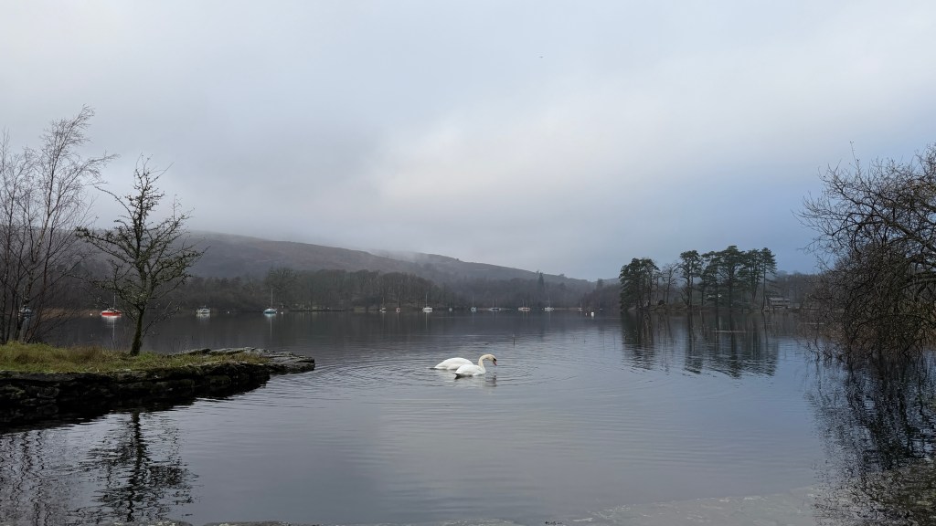
High Nibthwaite is at the southern end of Coniston and on the less visited eastern shore.
There isn’t really anywhere to park in the hamlet, but there is a small unmarked car park just outside to the north. There is also a field opposite this small car park which occasionally gets recommissioned as a place to leave your car, although on the day I last visited the field was full of impressive white cows. You will need the RingGo app for the field, the small carpark is free. When I say that the small car park is unmarked I mean that there are no signs at its entrance, you can’t see where the cars are parked from the road, and the entrance is down a rough track which immediately makes you doubt that a car park could be at the end of it. There is a grey metal post, but it doesn’t have any signs on it and it is shown on the OS Map. Here’s the link to the location of the small car park, if you zoom in close on Google Maps satellite view you’ll see a car parked in it.
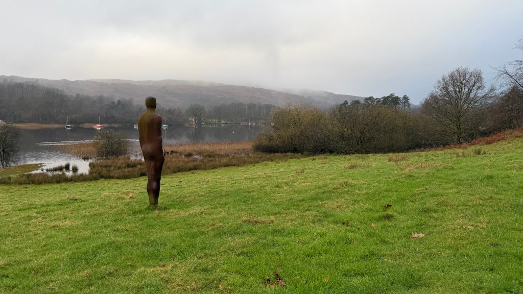
High Nibthwaite has its own artistic connections with Antony Gormley of Angel of the North and Another Place fame. At the edge of the hamlet is a house called The Stable at Lake End where Anthony visited in the 1980’s and where, in a field next to the boat house and quay he has left one of his famous iron sculptures looking out towards the Old Man of Coniston. It’s worth a visit to the sculpture and to take in the view at the quay by taking the footpath across the field (The footpath doesn’t go anywhere other than to the quay).
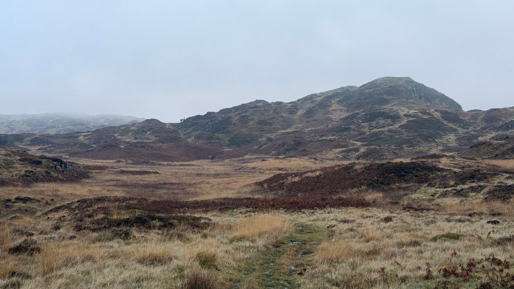
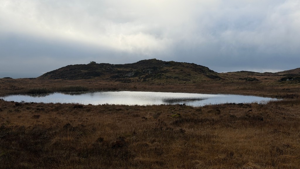
Much of this walk is across Bethecar Moor which is mostly trackless so you will need you map reading skills for this walk. The moor is a mixture of small rambling hills, gullies and bogs. There are marked paths on the map, but they aren’t as clearly defined on the ground. Don’t be fooled into thinking of this as a natural landscape though, like much of the Lake District this area has been shaped by people over a long time with some mining, coppicing, peat extraction and charcoal burning.
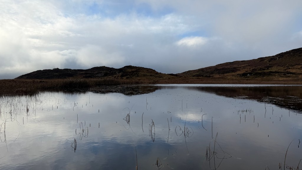
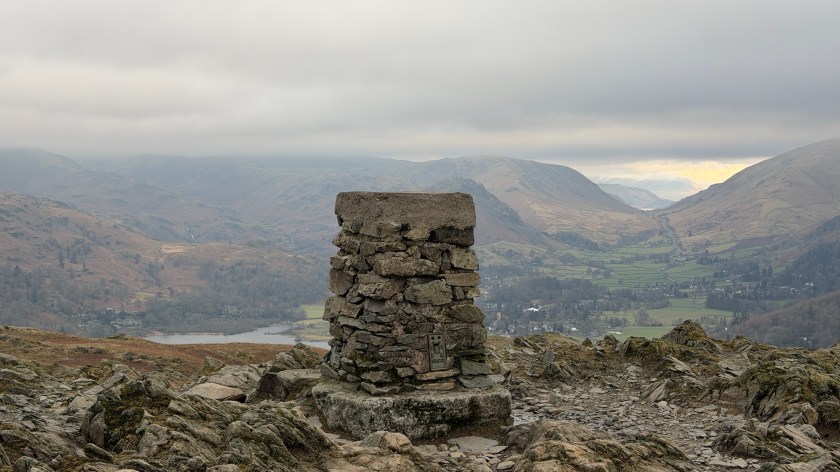
Near to the summit of the walk is Arnsbarrow Tarn which is a beautiful peaceful glacial tarn. The name “barrow” hints as the Bronze Age burial mounds nearby. People have been shaping this landscape for a very long time indeed.
This walk includes three Birketts – Stang Hill, Arnsbarrow Hill, and Top o’ Selside.
The name Top o’ Selside is a combination of Norse and English meanings. The Norse part Selside means seasonal pasture on a hillside, more Viking influence. The English part Top o’ says that it’s the highest point of.
The Walk
This is a medium length walk but I’ve marked it as difficult because of the need to navigate open moorland where the tracks are few and far between. In good weather the features are distinct, but in poor visibility it would be easy to become confused. Also, walking in this kind of open moorland is more tiring and slower going than on defined well marked tracks. The lack of tracks does give lots of opportunity to explore though.
We start this walk from the small unmarked carpark to the north of Coniston which is here. We are going to do this circular in an anti-clockwise direction, but you could do it the other way around. My choice of direction is solely down to a preference for coming down through the woods at the end rather than working my way up them at the beginning.
From the car park we head south along the road back into High Nibthwaite taking a short detour to visit the Gormley statue and to take in the views along the lake from the quay.
In the middle of the hamlet is a track off to left. This track is often used by off-road enthusiasts and mountain bikers, it forms part of our route down later on. For now, though, we are only following it for a short distance before heading along the path to the right along following route of a drystone wall to our right.
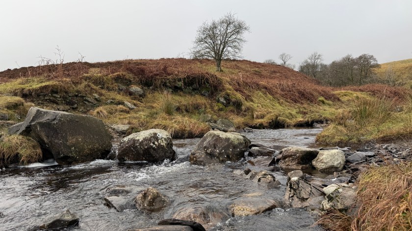
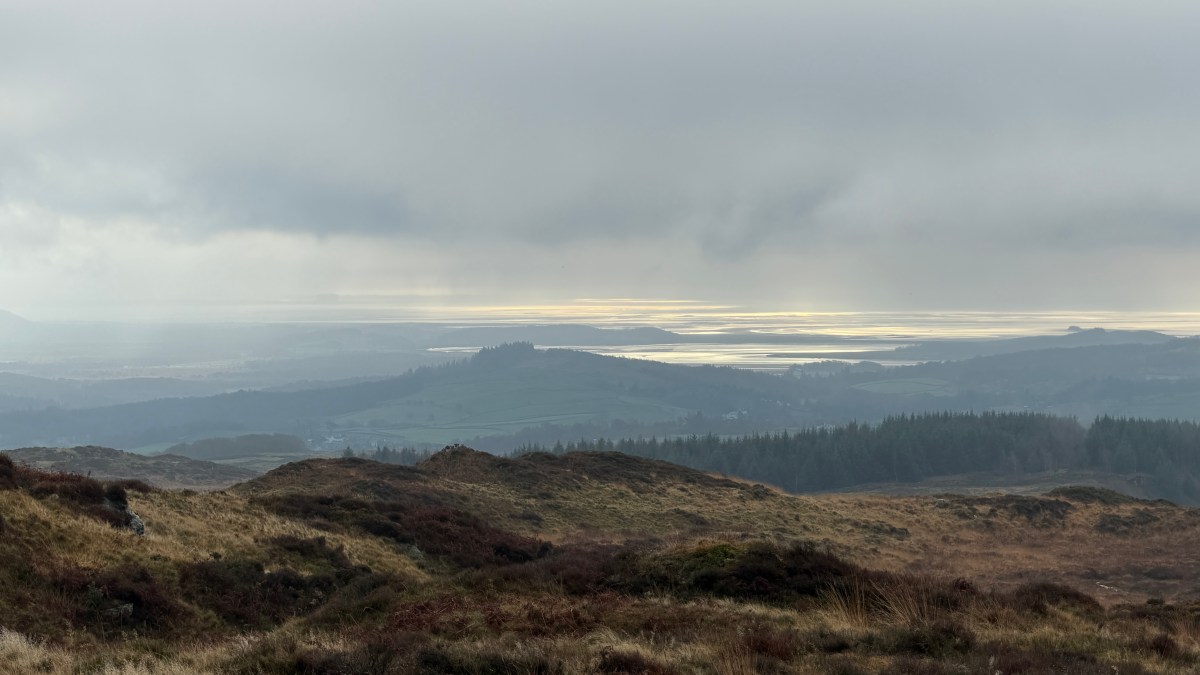
This path will take us along the route of Caws Beck which is in the woodland, to our right, and below the crags of Brock Barrow, on our left, to the farm at High Bethecar. This farm has fabulous views across the fells and Morecambe Bay but feels very isolated.
From High Bethecar we head out onto the moorland through a gate and along a track that steadily diminishes. We are looking for a fork in the path that takes us off to Stang Moss to the right. This is where you will need your map reading skills because it isn’t very clear on the ground where this fork is.
The route from Stang Moss to Arnsbarrow Hill is along a small ridge. If you are fortunate you can see the top of Arnsbarrow from Stang Moss and the route is almost straight there.
When we are picking our way along a route it’s easy to get engrossed in the few metres in front of us, be sure to lift your head and take a look around, this route has fabulous views.
Onward to Arnsbarrow Tarn which is worth a visit to take in the tranquility of it. You should be able to see the tarn from Arnsbarrow Hill. Work your way around the eastern side of the tarm up onto the Top o’ Selside.
The track down from the Top o’ Selside is probably the clearest part of this moorland part of the walk. The views across to the Old Man of Coniston are glorious on a good weather day. Part way along this part of our bimble you will start to see the bridleway that will form the next part of our exploring.
Once you’ve reached the bridleway turn left along it as it descends.
The last time I did this route there were two groups of off-road vehicles making their way up the hill. The noisy engines and tires felt like an invasion of privacy having been on my own in the quiet moorland. I can see why people would choose this route though, the views are fabulous.
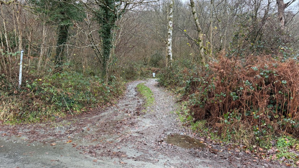
The bridleway will eventually draw alongside a wood on the right and then a little further along there is a gate into the wood. There’s only really one path down through the woods back to the carpark. This wood is nicely isolated and you should watch out for wildlife, when I last visited I saw a woodcock, a bird I’m not sure I’ve ever seen before.
Extensions and Variations
This route is mostly across moorland and this makes for infinite possibilities and variations.
Near the beginning of the walk you can choose to branch off and climb Brock Barrow which would be quite steep. Even if you don’t climb up the front you can branch off the defined path to the left to get some early views of the surrounding hills. From there you can cross moor to High Light Haws before branching off to Stang Moss.
If you were really wanting to maximise the number of Birketts that you covered on this walk you would take the route from Top o’ Selside to Carron Crag which is the only other Birkett in the area. Doing this would more than double the length of the walk and I’m not sure would add much more interest.