| Graham’s Walks | 📌 |
|---|---|
| Distance | 1.51 miles |
| Difficulty | Moderate |
| Map | 🗺️ |
| GPX | 📁 |
| Graham’s Cafe | Not on this one. Nearest: Chesters by the River. |
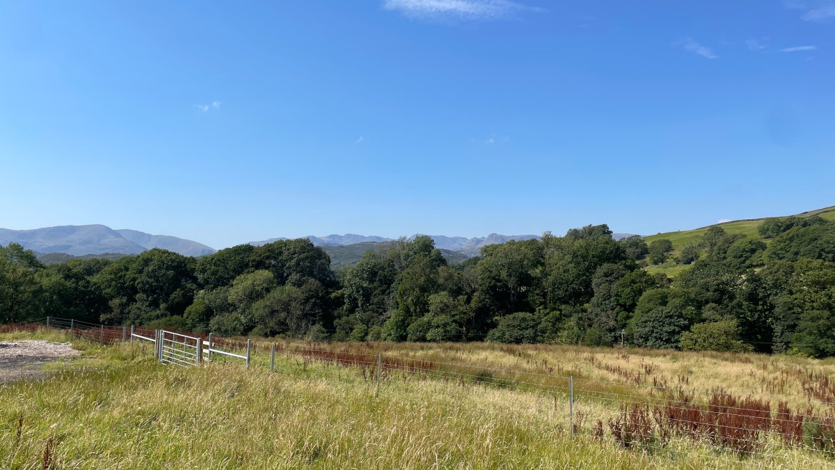
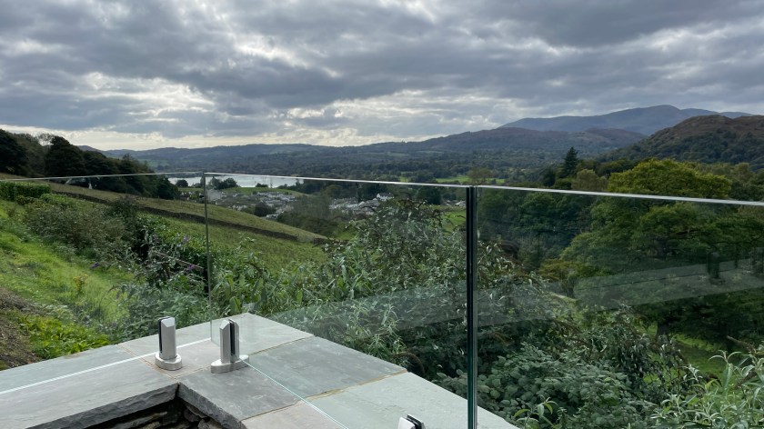
The Area
The Lake District is a wonderful place of natural features, but is also a place shaped by farming and mining. Many of the communities only exist because there was once employment available in the local quarry or mine. For thousands of years people have dug their way through the mountainsides in search of valuable rocks and minerals. This heritage is evident in many of the names; this walk, as an example, takes you over Slater Bridge which I’m assuming was the daily commute for the people who lived at the nearby Slaters Cottage as the retrieved slate from the nearby quarry. The mining around Little Langdale was primarily for copper and the green slate itself, which was used in building.
Bill Birkett, author of The Complete Lakeland Fells, is a Little Langdale local and gives a great overview of part of this route and further insights to the area in this countrystride podcast episode.
The village sits on the route of a Roman Road that linked Ambleside to Ravenglass on the coast, taking you over the twin passes of Wrynose and Hardknott which are still a challenge to drive today. As you’d expect from the Romans this is quite a direct route for such a mountainous area. On the side of Hardknott pass you can visit the remains of a Roman Fort, there’s also a Roman fort in Ambleside and a Roman bathhouse in Ravenglass. These are all linked to the time of Hadrian of wall fame. I do wonder sometimes what the Roman soldiers from Croatia felt about being stationed half way up a windswept fell in the Lake District with storms rolling in straight off the Irish Sea.
The Walk
This walk is a great starter walk with interest around every corner, there are also a wide variety of additions and diversions which are just as interesting.
Little Langdale is possibly the most acute for parking challenges in the whole of the Lake District. There are only a few road side parking spaces in the village and once they are gone, they are gone. This is where the alternatives come in with several of them providing additional parking options, do not attempt to park at the Three Shires Inn.
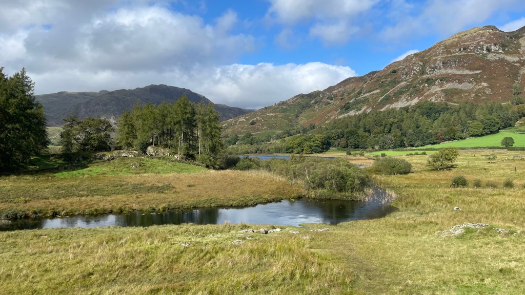
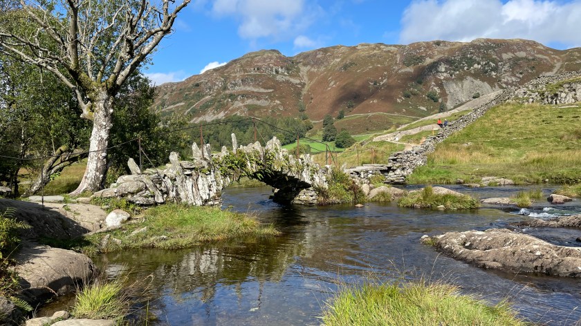
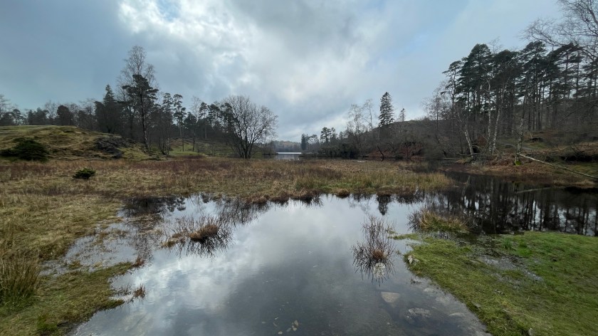
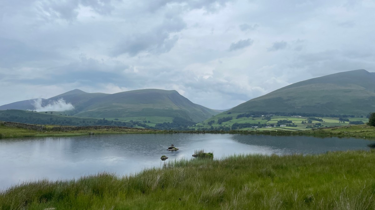
Once you’ve parked in the village make your way along the road, past the Three Shires Inn (there’s a story behind that name) and take the turn onto Fitz Steps. Down the hill a little you’ll see a path off to the right, up some steps and a small gate. This path will take you through a couple of fields and then down a small valley to Slater Bridge (which is sometimes spelled with an apostrophe but also without, also with an ‘s’ and without, depending on which map you read. I’m sticking with what it says on the OS Map and ignoring what those people on Google Maps think it is.) Slater Bridge has to be one of the most photographed places in the Lake District and rightly so. The Brathay that passes under the bridge is one of the main tributary rivers to Windermere. If you take a short detour to the right just before crossing the bridge, doubling back on yourself a little, you can get a great view up the valley across Little Langdale Tarn.
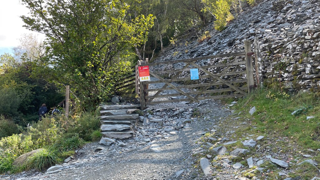
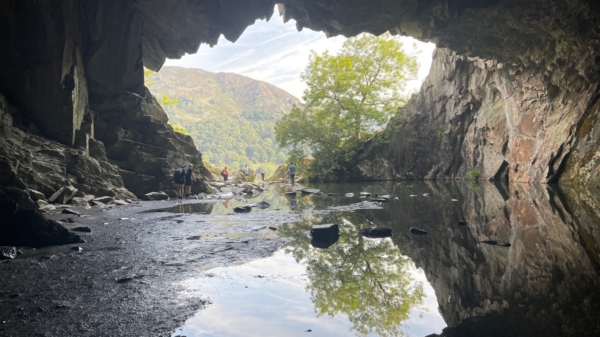
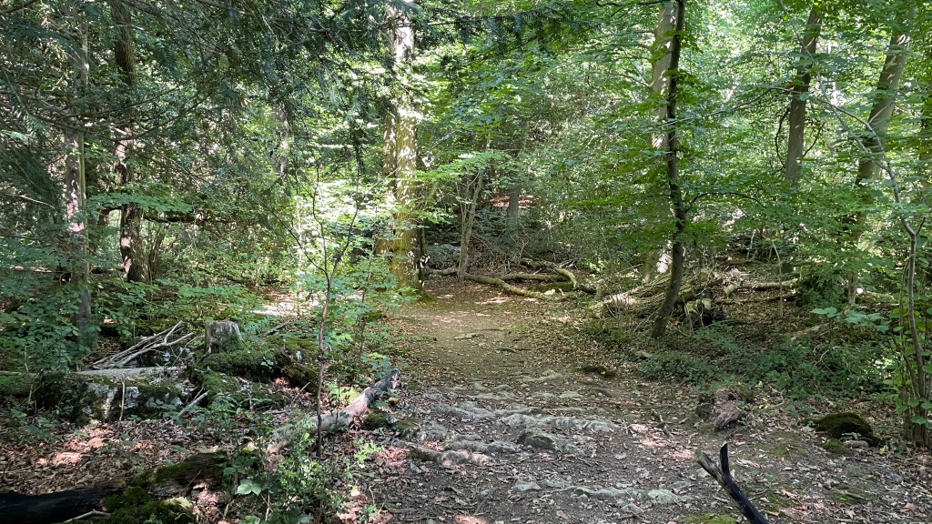
Having crossed the bridge head up a short hill and onto a track. Head left on the track with the river on your left. A short way along you’ll come to a gate and then not long after the gate you’ll see another gate to the right with directions into Cathedral Quarry. This is where you get to freestyle, depending on how adventurous you are. At the top of the short path you’ll find a tunnel through which you will find the famous Cathedral Cave, but that’s not the only option for getting into the cave and it’s certainly not the most adventurous. You can also head around the outside of the quarry gathering views into the caves as you go by taking the path off to the right as you look at the tunnel. The challenge with this path is in descent into the quarry which is steep and can be slippery.
These caves were all built by people digging out the rock, mostly by hand. The amount of graft alone is a marvel.
Beyond Cathedral Cave is the entrance to the main quarry which is vast. You can view the quarry by heading through the tunnel at the back of the cave and out into the open.
To get a full experience, however, you will need to do a little climbing. Before you climb too high though, please note that one of the routes out is the way you came in. Another route out is to scramble up the back of the quarry to the right on the slippery path. The final route out is via a cave for which you’ll need a light source, although it doesn’t have to be a very good light source, a smartphone torch will do. The cave is high enough to walk through and you can’t get lost because the only route off the cave is blocked off with fencing.
From the quarry floor you can view other excavations and tunnels. Last time we were in the quarry the army were practicing abseiling down the vast cliffs.
The easiest route out of the quarry is back down to the lane alongside the Brathay taking a right towards a wooden footbridge adjacent to a ford and connecting you back up to the end of Fitz Steps and onward back to your car. This simple route is less than 2 miles long including any roaming you’ve done inside the quarry.
Alternatives and variations
If you would like to use the cave route out of the quarry, go to the back of the quarry where you’ll notice a metal rope. Go to the end of the rope to your left and use it as a handrail in your right hand with the quarry wall on your left. This will help you across some boulders and into the cave which goes fairly straight through to the other side of the fell and out into a wood. If you take the path off to the left you will navigate down to a lane. If you turn left onto the lane it will take you back to the Brathay and the wooden footbridge at the end of Fitz Steps.
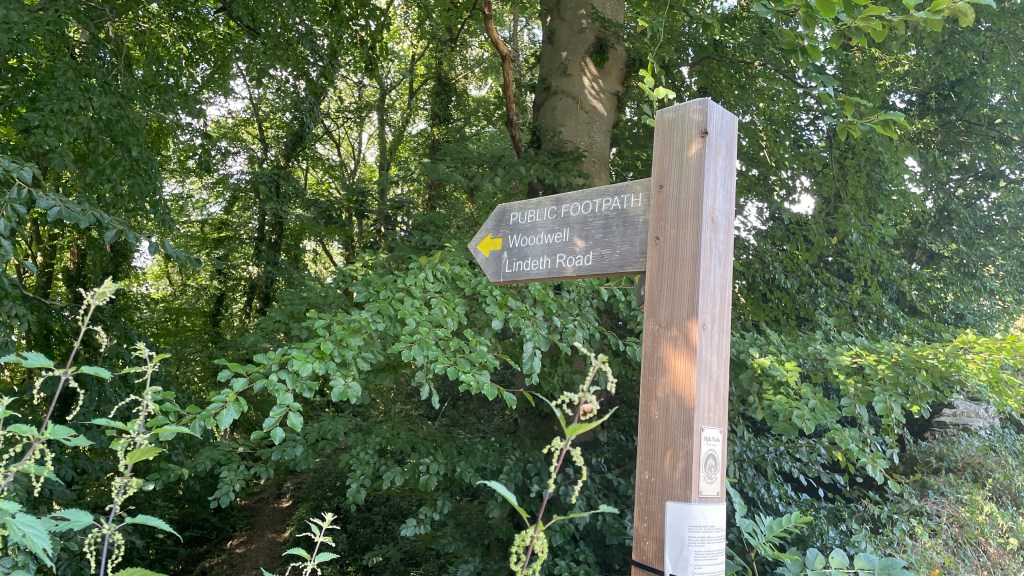
You can also extend the end of the walk a bit by heading back along the alternate lane from the wooden footbridge to Stang End. If you take the lane off to the left in Stang End, marked by a footpath sign for Little Langdale, it will take you to another footbridge across the Brathay and over a field back to the village.
There are several alternate starting points. Each is adding additional distance, interest and alternate parking:
Elterwater: The village has a good car park near to the beck. If you head out of the car park, along the road across the beck after a short while there is a lane to the right. This is the start of a bridleway route over into Little Langdale via Dale End Farm. There’s also a path the drops down into the back of the Three Shires Inn which makes for a good alternate route back.
Dale End Farm: There is a small car park at Dale End Farm, LA22 9NZ which is cash only and last time I checked was £5. From the end of the lane you can take the path almost straight across down to Slater Bridge.
Side Gates Car Park: There’s a small car park just as you head along the road into Little Langdale known as Side Gates. This is another cash-only car park and last time I looked it was also £5. From this car park head back to and across the road bridge over the river where you will find a stile into the woods. This path meanders alongside the river and past Colwith Force to Stang End. It’s up to you, from here, how much of the original route you include. You can take a right along the lane up into the village, carry straight on to the caves, cross the river at the wooden footbridge, or if you want an adventure, try to find your way into the caves via the tunnel cave.
There are also routes into Cathedral Quarry from Hodge Close and Tilberthwaite, but I think I’ll cover those routes as different guides.