
| Graham’s Walks | 📌 |
|---|---|
| Distance | 3.2 miles |
| Difficulty | Moderate |
| Map | 🗺️ |
| GPX | 📁 |
| Graham’s Cafe | Not on this one, but there is a cafe. If you are travelling from Preston The Lookout is on the route through Longridge. |
The Area
A conversation from my Polytechnic days has stuck in my mind for over 30 years now. One of the other students who was from somewhere in the south said “We went out to the Forest of Bowland over the weekend, but there aren’t any trees there.”
The area of hillside to the north west of Preston from roughly Whitechapel in the south-west up to Hornby in the north-west, across to Clapham in the north-east and Bolton-by-Bowland in the south-east is known as The Forest of Bowland and designated an Area of Outstanding Natural Beauty.
As my student friend suggests, if you associate forests with trees you’ll be disappointed, there haven’t been that many trees since the 17th century when the land was increasingly used for livestock. We don’t like changing the name of things in the UK.
Just beyond Inglewhite and Whitechapel, and just within the Forest of Bowland, lies a small hill know as Beacon Fell.
It’s currently owned by the local council and operated as country park. As the name suggests Beacon Fell was once a vital part of the national chain of beacons communicating major events a role it’s had for over 1,000 years.
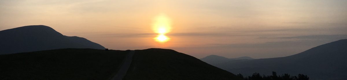
The fell is not very big, but it does sit on the edge of the west Lancashire lowlands giving it spectacular views across to the mountains of both Wales and the Lake District. On a day with good visibility you can see the Isle of Man, most days you can see the Manx ferry making its way in-to, or out-of Heysham. In the opposite direction you get great views of the more substantial Forest of Bowland fells including Parlick and Fair Snape.
As a country park Beacon Fell has good facilities with several car parks, lots of good paths and even a visitors centre with a cafe and toilets.
The Walk
This walk starts from the Sheepfold Car Park. There are a couple of reasons for this, the first is that this car park is free, unlike the one at the visitors centre although the one at the visitor centre only charges £1 for the day. The second reason is that there’s a back route to get here without travelling half of the circular one-way road around the fell.
I’ve called it ‘up hill and down dale’ because that’s the order I did the walk. I tend to prefer walks that go up and then come down, even if that means going down first to go up. This walk goes the other way around, you finish by going up, there’s really no way of avoiding that as the car park really isn’t very far from the top. You could minimise the amount of up at the end by doing the walk the other way around, that way around the walk back up to the car park wouldn’t be as steep.
This walk starts on the wide, well marked, paths of the Beacon Fell Country Park travelling around the park first before veering off into the surrounding farmland.
From the car park we are heading towards The Tarn along Larch Avenue which was previously the road up to a farm which stood where the visitors centre is now. It’s worth spending a little bit of time at The Tarn where the Dragonflies and Damselflies can be glorious.
There a little bit of tricky navigating here if you want to follow the same route as me, there are several paths that all converge here. You are aiming for the circular route that takes you between Quarry Wood and Quarry Car Parks. Don’t worry if you miss this and find yourself on a different route to the summit, that’s where you are heading eventually.
Part way along the circular route there’s a short cut-back connecting path that puts you on a path to the top. It’s worth taking what feels like a detour to experience the views on any day, but especially when the visibility is good.
Having reached the trig-point at the top it’s time to head back down to the circular path, but only for a short while. You are aiming for a point on this path where there is a sculpture known as The Lizard Love Seat on your left and a gate with a path heading down hill on your right which will take us down-dale.
Up to this point you could travel this walk almost any day of the year, beyond here we start to move into farmland and some of it is particularly boggy, so I don’t recommend it as a winter walk. This year has been dry for weeks and it was still wet in places. There’s no need to do this piece of the walk, if you want to get back to you car you can simply stay on he circular route. This part of the route is there to add interest and some different views.
At this point you should be heading down to the circular road then across the road down toward Sagar’s Farm (no idea who Sagar was), the path is marked by some nicely placed yellow topped posts. Before you get to Sagar’s farm, though, you’ll reach a not very well defined hedgerow cutting across your path, at this point you want to turn left along the line of the hedgerow.
The views of the Forest of Bowland Fells from here are spectacular. If you are fortunate you may even see a glider heading off from the nearby club, paraglider are also quite common floating off the top of the larger fells.
You are heading toward North Nook across a series of boggy fields via a set of stiles, each one marked by a yellow pole. All you have to do is find the stiles which isn’t always easy.
Just before North Nook you cross a road and along a path that feels a bit like you are walking through someone’s garden. Across the garden are two stiles close together. Once you come out the other side you are looking for a tall stile which isn’t quite where it’s marked on the OS map.
You’ll now make your way through some young woodland and then out into some more open scrub. You are looking for a path heading left on a steep incline. You are heading up into an area known as the Rosemary Bullivant Memorial Forest where each of the trees is dedicated to someone.
From the Memorial Forest you work your way to the right either via the visitors centre and toilets, or a less travelled route via the Jubilee Memorial.
There’s a path from the end of the visitor centre car park, across from the Orme sculpture, that takes you back up onto Larch Avenue and back to the Sheepfold car park.
Alternatives and Variations
There are so many variations to this walk I nearly didn’t write any. The country park is criss-crossed with paths that you can use to shorten or elongate this walk. I’ve already mentioned the option of missing out the down-dale part but then it would only be half the walk.
You can start the walk in one of the other car parks the walk passes nearby to most of them.
There are several sculptures around the park; this route only passes a couple of them, you can add in more of them if you head straight to the top from Sheepfold, passing the Heron, the Walking Snake and the Bat as you go. From there you can partially double back down to the tarn, or head down to the circular route and the Lizard Kissing Chair.
On the map there are various options from extending the down-dale part of the walk also, but I’ve not walked any of them so can’t comment on their suitability.


Discover more from Graham Chastney
Subscribe to get the latest posts sent to your email.
I like to cycle there, do the walk, have a picnic and cycle home