| Graham’s Walks | 📌 |
|---|---|
| Distance | 5.3 miles |
| Difficulty | Easy |
| Map | 🗺️ |
| GPX | 📁 |
| Graham’s Cafe | Atkinsons The Castle Atkinsons The Hall |
The Area
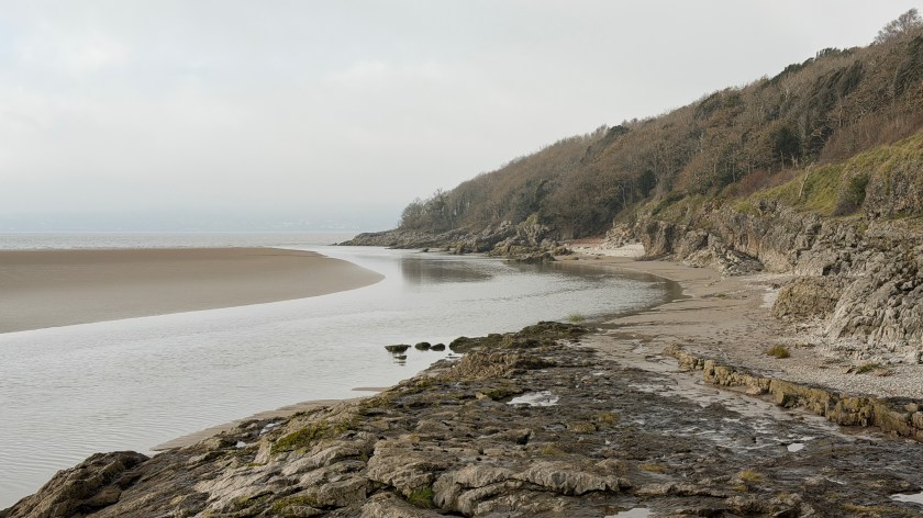
This walk takes us alongside two waterways – the River Lune and the Lancaster Canal.
The origins of Lancaster date back to the Romans who established a fort on the hill where the current castle resides somewhere between 60 and 73 AD. This enabled them to oversee the river crossing at this point and monitor ships coming in from the Irish Sea. The name “Lancaster” is a corruption of the Old English Loncastre, meaning “the Roman fort on the River Lune”. “Lon” being the name of the River Lune, and “castre” originating from the Latin castra, meaning “camp” or “fort”. No one seems to be clear about the meaning on “Lon.”
The current castle, which we will visit on the walk, was started by the Normans somewhere around the 1090s with alterations and additions taking place across the centuries.
In 1792 work started on a new waterway across Lancaster – the Lancaster Canal. The history of the canal follows a similar one to many of the canals across the country. An initial construction was based on transporting heavy good, not long after construction it was made obsolete by the railways and fell into disrepair, being restored into a new role as a place of leisure. Lancaster Canal became known as “the black and white canal” because of the transportation of coal north and limestone south.
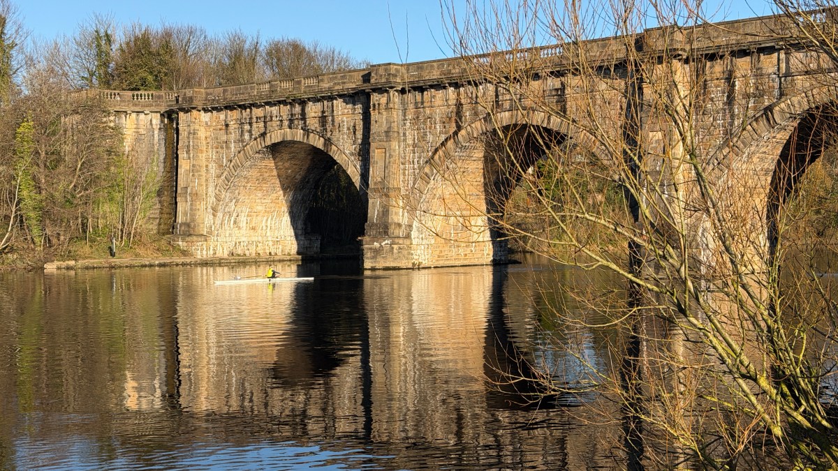
The two watercourses intersect at the Lune Aqueduct which is where we start our walk. The Aqueduct is the largest stone built aqueduct in the country and is worth a visit even if you aren’t going to walk too much further. The costs of the aqueduct were nearly three times those originally planned and lead to the cancelation of an aqueduct over the Ribble at Preston and the connection to the Leeds Liverpool Canal being replaced by a tram.
(As I write this the tram bridge across the Ribble, that replaced the aqueduct, is itself being replaced. The original canal bridge was never as impressive as the Lune aqueduct. They were clearly being far more careful with the money by then.)
On this walk we follow the river into Lancaster and the canal on the return journey.
The Walk
We start this walk at the small, free, Canal and Rivers Trust Car Park next to the Lune Aqueduct on the A589. The entrance to the car park is right next to the car park for McDonalds.
In one corner of the car park is a path leading you alongside the canal embankment to the river.
Once you get to the river turn left and follow the path into Lancaster.
This is a well paved path which is shared with cyclists.
There are a few places where it’s possible to get a view of the river, but for much of this early section the view is regularly obscured by trees. The closer you get to Lancaster, the fewer the trees.
Nearing the end of this section you will arrive at several bridges carrying roads and footpaths across the river. Don’t cross any of the bridges, carry along the footpath until you see a fingerpost pointing up the hill to Priory on the left.
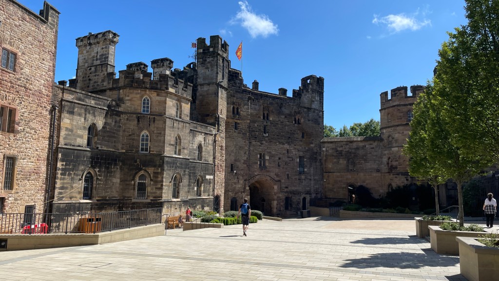
On your way up the hill you will pass the ruins of the Roman Bathhouse.
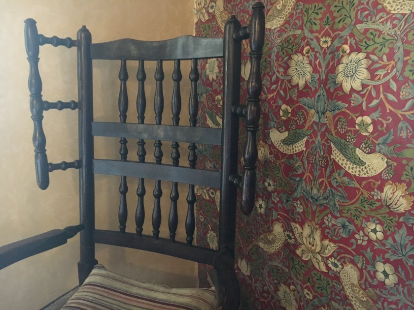
At the top of the hill is Lancaster Priory with Lancaster Castle next to it. Both the priory and the castle are worth a visit while you are here. Inside the castle is the Atkinsons The Castle location, there’s more about the castle in the Graham Guide for the cafe. There is a huge amount of history in this small area.
Having refreshed yourself at the castle we are going to make our way across to the canal. There are several routes to the canal depending on your appetite to explore. You could head down to King Street, which is the main road into Lancaster, and head up the hill towards the hospital. You’ll arrive at the canal next to the Toll House Inn. Alternatively you can avoid the main road and take in the urban splendour of Fenton Street, High Street and Regent Street. Another alternative is to head a little way up the hill of Meeting House Lane towards the train station and then left onto Dallas Road. It doesn’t really matter where you meet the canal but you shouldn’t cross the rail tracks on any of these routes.
Follow the canal towpath towards the aqueduct which would mean heading left on the routes outlined above. If you are at all doubtful about your direction the aqueduct is labelled on many of the fingerposts on the towpath. There are a couple of places where the towpath crosses to the other side of the canal, these are well labelled.
The towpath will head out of Lancaster and bring you onto the aqueduct from where you will be able to find the car park.
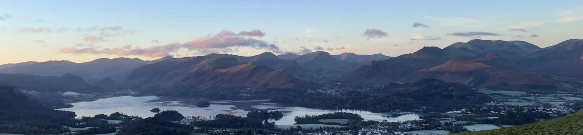
The map shows crossing the aqueduct at the end of the walk. This is a short, non-circular part of the walk, traversing the structure and then returning to your car. You can do this at the beginning if that’s what you choose to do. Whether at the beginning or the end of the walk don’t miss this part out, the views are wonderful.
You shouldn’t need boots for this walk unless, like me, you like tramping away from the footpath.
Extensions and Variations
There are a few variations for this walk but they’re quite minor. As well as the ones I’ve highlighted you can walk a little further along the riverbank before cutting back to the castle area.
Atkinsons at the castle is lovely, particularly on a sunny day. On a wetter colder day I, personally, find Atkinsons The Hall a bit more cosy. The Hall isn’t far from the castle.